New database on tectonic plates
September 23, 2014

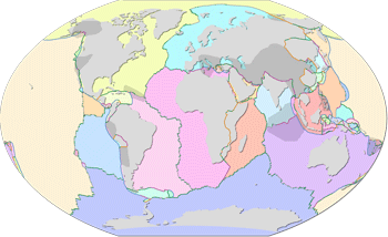
Nordpil is proud to announce publiction of the new Tectonic plates GIS database. This collection of GIS data is an update and conversion of an existing scientific resource, in modern data formats.
It is a conversion of the dataset originally published in the paper An updated digital model of plate boundaries in 2003. The original data has been parsed, cleaned and verified using ArcGIS 10.2 and converted to shape files. The dataset presents tectonic plates and their boundaries. It is useful for geological applications, analysis and education, and should be easy to use in any modern GIS software application.
The data, available for download through GitHub, has been released under a public domain license for unrestricted usage.
 Follow Nordpil on Twitter!