 Follow Nordpil on Twitter!
Awards and other forms of recognition
A testament to our services and expertise, Nordpil has been recognized for excellent and powerful visual communication by national and international institutions since founding up until the present.
-
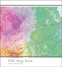
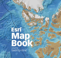 ESRI Map book vol 29, 2014
-
The annual ESRI Map Book presents a selection of the best maps prepared using ESRI ArcGIS software in the previous year. The book is presented at the ESRI International User Conference in San Diego, in July. The 2014 map book, volume 29, was presented at the conference held on July 14-18, 2014. A map by Hugo Ahlenius, Nordpil, was selected for inclusion in this showcase. Soon available to read online at the ESRI Map Book Gallery and for order through the ESRI store.
-
 26th International Cartographic Conference
-
Two maps by Nordpil were selected to represent Swedish cartography at the 2013 International Cartography Association (ICA) conference in Dresden, Germany, held in August 2013. The map posters were originally prepared for the 2012 Kartdagarna map exhibition and present protected areas in the Arctic and the bathymetry of the Arctic Ocean.
-
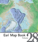 ESRI Map book vol 28, 2013
-
The annual ESRI Map Book presents a selection of the best maps prepared using ESRI ArcGIS software in the previous year. The book is presented at the ESRI International User Conference in San Diego, in July. The 2013 map book, volume 28, was presented at the conference held on July 8-12, 2013. Four maps by Hugo Ahlenius, Nordpil, are featured in the book, including a bathymetry map of the Arctic Ocean on the cover. Available to read online at the ESRI Map Book Gallery and for order through the ESRI store.
-
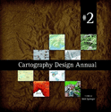 Cartography Design Annual 2
-
The second Cartography Design Annual features selected outstanding examples of map artwork published in 2008. The maps were chosen based on the clarity of the information, the appeal of the visual design, and the quality of the production. A map by Hugo Ahlenius, prepared for UNEP/GRID-Arendal, was selected for this volume. The map presents climate scenarios for the Arctic region. See map portfolio to view this map. The report can be ordered from the publisher.
-
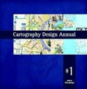 Cartography Design Annual #1
-
The Cartography Design Annual is a book showcasing a collection of the best maps. For the 2008 volume a world map presenting the various elements of the cryosphere was included.
For more information and ordering, see http://www.lulu.com/shop/nick-springer/cartography-design-annual-1/paperback/product-3327040.html. -
 ESRI Map book vol 23
-
The annual ESRI Map Book presents a selection of the best maps prepared using ESRI ArcGIS software in the previous year. The book is presented at the ESRI International User Conference in San Diego, in July. The 2008 map book, volume 23, was presented at the conference held on July 2008. A world map prepared for the UNEP Global Outlook of Ice and Snow was included in this volume, showing the distribution and different elements of the cryosphere.
-
 ESRI Map book vol 22
-
The annual ESRI Map Book presents a selection of the best maps prepared using ESRI ArcGIS software in the previous year. The book is presented at the ESRI International User Conference in San Diego, in July. The 2007 map book, volume 22, was presented at the conference held on July 2007. An Arctic topographic map prepared for the Arctic Council working group on conservation was selected for this collection.
-
 Stockholm Challenge Award, finalist
-
The Stockholm Challenge rewards innovation and entrepreneurship in ICT and digital channels. The Baltic Sea Region GIS, Maps and Statistical Database was selected as one of the finalists in the Environment Category for the 2001 awards.
-
 Geography Network Challenge Award (3rd place)
-
The Geography Network Challenge was open to all organizations hosting live map services or spatial solutions on the Geography Network. Sites were judged on creativity, performance, documentation, user-friendliness, and visual clarity. UNEP/GRID-Arendal was awarded 3rd place for the map service "Conservation Image Service–Greenhouse Gases and the Kyoto Protocol" implemented by Hugo Ahlenius using ESRI ArcIMS and custom JavaScript programming.