 Follow Nordpil on Twitter!
Publications
List of reports, newsletters, books and other publications that has published work by Nordpil. For some of these Nordpil has served as graphics editor and prepared and managed all the illustration work, others feature maps, diagrams or charts that we have prepared.
2016
-
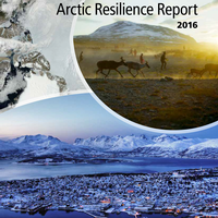
Arctic Resilience Report
-
November 25, 2016
The multidisciplinary study is a comprehensive assessment of Arctic change and
resilience, including factors that appear to support or weaken resilience. It
provides an overview of tools and strategies that can be used to assess and
build resilience in the Arctic, and considers how the Arctic Council can
contribute to those efforts. Hugo Ahlenius of Nordpil prepared all illustrations
for the report, in close collaboration with the editorial team and contributing
scientists. The report is
available on the Stockholm Environment Institute website.
-
-
Shared Voices Magazine 2016
-
August 17, 2016
For the 2016 edition of Shared Voices magazine, which is the annual
newsletter and annual report of the University of the
Arctic, Hugo Ahlenius prepared an updated map of University of
the Arctic members across the circumpolar Arctic, using ArcMap and Adobe
Illustrator based on data supplied by the University of the Arctic
secretariat.
-
-
Water and human livelihood resilience: a regional-to-global outlook
-
June 10, 2016
Scientific article, published in the Springer journal International
Journal of Water Resources Development. Hugo Ahlenius of
Nordpil assisted the author, Malin Falkenmark of Stockholm University,
by preparing all illustrations for this article. He also prepared the
document for submission, including reference management and formatting.
The article reviews the current and future freshwater roles, needs and
uses. Article
available on the Springer website.
-
2014
-
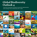
Global Biodiversity Outlook 4
-
October 6, 2014
Global Biodiversity Outlook (GBO) is the flagship publication of the
Convention on Biological Diversity. It is a periodic report that
summarizes the latest data on the status and trends of biodiversity
and draws conclusions relevant to the further implementation of the
Convention. The fourth edition of the Global Biodiversity Outlook
draws on various sources of information to provide a mid-term
assessment of progress towards the implementation of the Strategic
Plan for Biodiversity. A map by Hugo Ahlenius, Nordpil, on Arctic
indigenous languages is featured in the report. The report is
available on the CBD website.
-
-
WWF Living Planet Report 2014
-
September 30, 2014
The Living Planet Report documents the state of the
planet—including biodiversity, ecosystems, and demand on
natural resources—and what this means for humans and
wildlife. Published by WWF every two years, the report brings
together a variety of research to provide a comprehensive view
of the health of the earth. A map by Hugo Ahlenius, Nordpil, was
featured displaying human impact on coastal areas, with the
state in 2002 alongside a GLOBIO scenario for 2050. The report
is available from the WWF
Living Planet Report website.
-
-
ESRI Map book vol 29, 2014
-
July 14, 2014
The annual ESRI Map Book presents a selection of the best
maps prepared using ESRI ArcGIS software in the previous
year. The book is presented at the ESRI International User
Conference in San Diego, in July. The 2014 map book, volume
29, was presented at the conference held on July 14-18,
2014. A map by Hugo Ahlenius, Nordpil, was selected for
inclusion in this showcase. Soon available to read online at
the ESRI Map Book
Gallery and for order through the ESRI
store.
-
-
Shared Voices Magazine 2014

-
May 1, 2014
For the 2014 edition of the Shared Voices
magazine, the annual newsletter and annual report of the
University of the Arctic (a circumpolar network
of institutions), Hugo Ahlenius of Nordpil prepared a
set of maps and diagrams. The illustrations demonstrate
the wide span of the network in a map showing its
geographic distribution, as well as in a graphic on
student exchanges around the Arctic. The
magazine is available from University of the
Arctic.
-
-
Water Resilience for Human Prosperity
-
March 21, 2014
Humanity now constitutes the largest driving force
for changes to the biosphere, and as a result of our
actions, we are facing critical challenges. How can
we handle governance and management of water
resources in the context of rapid global change?
Water Resilience for Human Prosperity
(Rockström, Falkenmark, Folke et al)
presents a new approach to water, addressing
global sustainability and focusing on
socio-ecological resilience. Topics covered include
the risks of unexpected change; human impacts and
dependence on global water; the prospects for
feeding the world’s population by 2050; and a
pathway for the future. Hugo Ahlenius of Nordpil
coordinated the book production, prepared all the
graphics and managed communication with the authors.
Read more about the book on the Stockholm
Resilience Centre website and at Cambridge
University Press.
-
-
Arctic Ocean Acidification 2013: An Overview
-
March 1, 2014
Arctic Ocean Acidification 2013: An
Overview summarizes the results of a
study by the Arctic Monitoring and Assesment
Programme (AMAP) featuring
contributions from scientists from throughout
the circumpolar north. The assessment examines
how ocean acidification is affecting the Arctic
seas, marine life, and the peoples of the
Arctic, and considers future impacts of ocean
acidification. Hugo Ahlenius of Nordpil prepared
maps, charts and diagrams for the report, and
handled some of the data management for the
scientific report. The
report is available for download from
AMAP.
-
2013
-
AMAP Assessment 2013: Arctic Ocean Acidification
-
December 1, 2013
Acidification in the world's seas is
happening at a rapid and accelerating pace,
and the Arctic Ocean is one of the
frontlines for this global change. This
assessment summarizes the state of science
on the Arctic seas, and how this is
affecting the marine environment, as well as
possible developments for the future - for
Arctic marine life and Arctic peoples. Hugo
Ahlenius, Nordpil prepared maps, charts and
diagrams for the report, as well as handled
some of the data management. The
report is available for download from
AMAP.
-
-
Life Linked to Ice: a guide to
sea-ice-associated biodiversity in this time
of rapid change
-
October 17, 2013
Report from the Arctic Council, and the
Conservation of Arctic Flora and Fauna
(CAFF) working group that examines
sea-ice-associated biodiversity on land
in the marine, and climate change. As
the ice is reduced, the report looks at
the impacts for marine species as well
as human communities. The report
features maps by Hugo Ahlenius, Nordpil.
Report
available from CAFF.
-
-
Essential Mapwork Skills 3
-
September 1, 2013
Textbook teaching geographical skills
designed for GCSE and A Level
specifications, by Simon Ross and
published by Nelson Thornes. The
book features thirty case studies on
physical, human and issue-based
geographical topics. An Arctic
topographic map by Hugo Ahlenius,
Nordpil is provided to give context
to a case on global warming and the
fate and future of the Arctic sea
ice. For
more information, please refer
to Nelson Thornes.
-
-
Sweden’s evolving hydropower sector:
Renovation, restoration and
concession change
-
August 1, 2013
A new report from the Stockholm
Environment Institute reviews
developments in Sweden's
hydropower sector between 1990
and 2012. The report Sweden’s
evolving hydropower sector:
Renovation, restoration and
concession change by
Peter Rudberg focuses on
existing infrastructure and
installations and on their
maintenance and upgrades. It
also examines the measures taken
to restore and maintain
ecological qualities in the
affected rivers. To provide an
overview of the case studies in
the report, Nordpil prepared an
overview map of the hydropower
stations covered, including
descriptions.
-
-
ESRI Map book vol 28, 2013
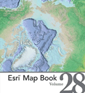
-
July 8, 2013
The annual ESRI Map Book
presents a selection of the
best maps prepared using
ESRI ArcGIS software in the
previous year. The book is
presented at the ESRI
International User
Conference in San Diego, in
July. The 2013 map book,
volume 28, was presented at
the conference held on July
8-12, 2013. Four maps by
Hugo Ahlenius, Nordpil, are
featured in the book,
including a bathymetry map
of the Arctic Ocean on the
cover. Available to read
online at the ESRI
Map Book
Gallery and
for order through the ESRI
store.
-
-
Shared Voices Magazine 2013
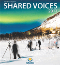
-
May 17, 2013
Graphics previously
prepared by Nordpil were
updated in early 2013
with new data:
statistics of exchanges
in the University of the
Arctic North2North
student mobility
program. The program
allows exchanges among
higher education
institutions in the
Arctic. Several maps and
circular diagrams were
prepared, one of which
is featured in the 2013
issue of Shared Voices
magazine. Read
more on the
University of the
Arctic website.
-
-
Arctic Resilience
Interim Report 2013
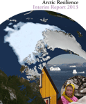
-
May 15, 2013
The Arctic Resilience
Interim Report 2013
was presented in May
at the Kiruna
Ministerial meeting
of the Arctic
Council. The interim
report represents a
major milestone in a
multi-year effort in
creating a
comprehensive
assessment on the
state and resilience
of the
socio-ecological
systems of the
circumpolar north.
Nordpil collaborated
closely with the
editorial team and
contributing
scientist to prepare
all the diagrams,
charts and maps in
the interim report.
The visuals were
prepared to
communicate the
process and results
in a clear and
legible way for a
wide audience. To
read more about
the report, and
for download
link, please
refer to the
Arctic
Council
Arctic
Resilience
Report
website:
http://www.arctic-council.org/arr/
-
2012
-
Climate change
adaptation in
Swedish forestry: a
historical overview,
1990-2012
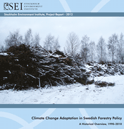
-
December 12,
2012
This report
explores how
climate change
adaptation
concerns were
integrated into
the Swedish
forestry
discourse in the
period
1990–2010.
Nordpil prepared
overview map,
charts and
assisted with
the design of
the tables. Report
available
from
SEI.
-
-
Competing water
claims in
biofuel
feedstock
operations in
Central
Kalimantan
-
November 3,
2012
This SEI
working
paper gauges
the impacts
of palm oil
plantations
from the
perspective
of local
communities
in Central
Kalimantan,
Indonesia,
and
identifies
governance
issues. It
finds that
local
communities
in Central
Kalimantan
Province
have severe
grievances,
reporting
that
plantations
pollute
local
rivers,
lakes and
aquifers,
harming
drinking
water and
killing
fish, and
also drying
up community
wells.
Nordpil
prepared an
overview map
integrating
data and
information
from various
sources. Report
available
from
SEI.
-
-
Results from
survey on
use and
capacity in
using
graphics to
communicate
environment
and
sustainable
development
issues
-
June
28, 2012
Results
from
survey
on use
and
capacity
in using
graphics
to
communicate
environment
and
sustainable
development
issues
in 2010,
to learn
more
about
the way
environmental
and
sustainable
development
professionals
use
charts,
maps and
diagrams,
a short
survey
was
prepared.
The
results
are
published
in this
report,
and they
provide
an
interesting
picture
of needs
and
capabilities
in for
preparing
and
using
graphics
for
communication
related
to
climate
change,
environmental
issues
and
sustainable
development.
The
results
are been
summarized
in this
report.
Report
available
from
this
website.
-
-
Snow,
Water,
Ice and
Permafrost
in the
Arctic
(SWIPA)
Scientific
report
-
May
14,
2012
The
assessments
in
Snow,
Water,
Ice
and
Permafrost
in
the
Arctic
(SWIPA)
represent
an
important
milestone
in
the
study
of
climate
change
and
its
impacts.
The
report
examines
changes
in
snow
cover,
temperatures,
glaciers,
ice
caps,
permafrost
and
sea
ice.
A
key
finding
is
that
virtually
all
parts
of
the
arctic's
frozen
regions
are
being
affected
by
increases
in
temperature.
Released
in
April
2012,
the
report
is
the
result
of
many
years
of
work,
and
includes
contributions
from
a
diverse
range
of
institutions.
Nordpil
assisted
in
preparing
graphics
and
data
research.
The
report
is
available
from
AMAP.
-
2011
-
Arctic
Protected
Areas
Monitoring
Scheme
Background
Paper
-
December
6,
2011
As
a
benchmark
and
background
study,
the
conservation
programme
of
the
Arctic
Council
has
performed
an
inventory
of
protected
areas,
such
as
national
parks,
in
the
circumpolar
arctic.
The
Conservation
of
Arctic
Flora
and
Fauna
(CAFF)
has
examined
the
current
status
using
best
available
data
to
review
the
status
of
protection
of
land
and
marine
environments.
The
report
was
published
in
the
CAFF
Monitoring
Series,
as
report
#5.
Nordpil
prepared
all
the
national
and
circumpolar
maps
for
this
study.
The
report
is
available
on
the
Arctic
Portal
website.
A
map
from
this
report
has
been
added
to
the
portfolio
section:
Protected
Areas
of
the
Arctic.
-
2010
-
TheGlobe

-
November
8,
2010
A plugin
for
Petrel
for
interactive
management,
browsing
and
exploration
of
continental
shelves
and
the
ocean
floor
in
a
3D
view.
Nordpil
prepared
a
number
of
layers
for
background
information
on
geology
and
environmental
factors
for
the
sea
column.
Available
for
purchase
through
the
Ocean
Store.
-
-
Protecting
Arctic
Biodiversity
-
October
27,
2010
An
in-depth
review
of
existing
multilateral
environmental
agreements
and
their
role
for
the
Arctic
environment,
including
treaties
such
as
the
Convention
on
Biological
Diversity
(CBD).
The
report
covers
selected
case
studies
on
such
topics
as
climate
change,
polar
bears,
seals
and
an
ecosystem
approach.
Nordpil
worked
with
the
editors
to
prepare
maps
for
the
report,
including
adapting
existing
graphics
from
the
UNEP/GRID-Arendal
graphics
library.
The
publication
is
available
on
the
UNEP/GRID-Arendal
website,
and
graphics
from
the
report
have
been
published
at
maps.grida.no.
-
-
The
Last
Stand
of
the
Orangutan
-
State
of
emergency:
illegal
logging,
fire
and
palm
oil
in
Indonesia's
national
parks
(Rapid
Response
Assessment)
-
June
29,
2010
A study
in
the
UN
Environment
Programme
Rapid-Response
Assessment
series,
on
the
status
of
Orangutans
-
trade,
deforestation
and
habitat
destruction
in
Malaysia
and
Indonesia
-
Sumatra
and
Borneo.
Graphics
editor,
research,
data
collection
and
preparation
of
all
graphics
for
the
report.
See
the
report
website
for
more
information
and
this
link
for
the
graphics
prepared
for
the
report.
-
-
Arctic
Biodiversity
Trends
2010:
Selected
indicators
of
change
-
May
5,
2010
An
overview
of
the
ecology
of
the
Arctic
is
presented
in
the
report
Arctic
Biodiversity
Trends
2010:
Selected
Indicators
of
Change,
presented
by
the
Arctic
Council
in
May
2010.
Nordpil
prepared
all
the
maps,
charts
and
diagrams
for
this
publication,
and
worked
closely
with
the
editorial
team
from
UNEP/GRID-Arendal
and
the
CAFF
Secretariat.
Two
maps
from
this
report
are
presented
in
the
portfolio
section:
red
knot
migration
and
vegetation
trends
in
the
Arctic.
The
report
is
available
from
the
arcticbiodiversity.is
website.
-
2009
-
Catalysing
change
-
the
UNECE
response
to
the
climate
countdown
-
December
5,
2009
Some
of
the
member
states
of
the
United
Nations
Economic
Commission
for
Europe
(UNECE),
notably
the
US and
Canada
and
some
EU
member
states,
are
among
the
main
emitters
of
greenhouse
gases.
The
report
Catalysing
change
-
the
UNECE
response
to
the
climate
countdown,
prepared
for
the
COP15
climate
conference
in
December
2009,
summarizes
activities
among
UNECE
member
states
to
mitigate
and
act
on
climate
change.
Nordpil
prepared
and
edited
all
illustrations
for
this
report
(partly
based
on
previous
work
by
UNEP/GRID-Arendal).
Full
layout
and
graphic
design
by
Nordpil.
Three
illustrations
from
this
report
are
presented
in
the
portfolio
section:
cover,
cartogram
and
a
chart.
The
report
is
available
for
download
from
the
UNECE.
-
-
Cartography
Design
Annual
#2
-
December
1,
2009
The
second
Cartography
Design
Annual
features
selected
outstanding
examples
of
map
artwork
published
in
2008.
The
maps
were
chosen
based
on
the
clarity
of
the
information,
the
appeal
of
the
visual
design,
and
the
quality
of
the
production.
A
map
by
Hugo
Ahlenius,
prepared
for
UNEP/GRID-Arendal,
was
selected
for
this
volume.
The
map
presents
climate
scenarios
for
the
Arctic
region.
See
map
portfolio
to
view
this
map.
The
report
can
be
ordered
from
the
publisher.
-
-
Effekt
-
klimatmagasinet
2009/2
-
November
1,
2009
The
2009/02
issue
of
the
Swedish
climate
magazine
Effekt
features
maps
prepared
by
Nordpil.
The
illustrations
accompany
an
article
on
vulnerability
to
climate
change
in
Sweden.
See
map
portfolio
for
samples.
The
report
is
available
from
the
publishers.
-
-
UArctic
Shared
Voices
-
Thematic
Networks
issue
-
May
14,
2009
Nordpil
contributed
a
series
map
illustrating
the
networks
of
the
University
of
the
Arctic
using
data
supplied
by
the
UArctic
secretariat.
The
data
was
then
manipulated
and
georeferenced
to
match
the
background
map.
See
map
portfolio
for
sample
and
links.
-
-
Poverty
and
Environment
Times
#5:
The
Pro-Poor
Growth
Issue
-
May
12,
2009
Participated
in
the
editorial
team
and
designed
maps
and
charts
for
the
newspaper.
The
publication
is
available
on
the
Environment
Times
website,
and
from
the
UNEP/GRID-Arendal
maps
and
graphics
library.
-
-
Reindeer
husbandry
and
Barents
2030
-
Impacts
of
future
petroleum
development
on
reindeer
husbandry
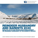
-
May
6,
2009
The
future
for
reindeer
husbandry
in
the
Barents
region
is
highly
dependent
on
the
availability
of
grazing
land.
Extensive
oil
and
gas
development
will
likely
lead
to
loss
of
vital
ranges,
in
particular
coastal
summer
pastures
and
calving
grounds.
Reindeer
husbandry
and
Barents
2030
presents
new
potential
scenarios
for
reindeer
husbandry,
combining
the
GLOBIO
methodology
for
mapping
loss
of
biodiversity
with
the
extensive
oil
and
gas
development
pictured
in
the
scenarios.
Maps
and
analysis
by
Nordpil
are
used
in
the
report.
Full
report
available
from
UNEP/GRID-Arendal.
-
-
The
Environmental
Food
Crisis
-
The
Environment's
Role
in
Averting
Future
Food
Crises
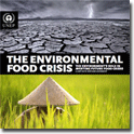
-
February
7,
2009
Nordpil
prepared
30
illustrations,
with
research
and
documentation,
in
close
collaboration
with
the
editorial
team.
Hugo
Ahlenius
served
as
graphics
editor.
Full
report
and
more
information
available
from
UNEP/GRID-Arendal,
all
graphics
are
accessible
in
the
UNEP/GRID-Arendal
maps
and
graphics
library.
-
-
Natural
Resources
and
Pro-Poor
Growth
-
DAC
Guidelines
and
References
Series
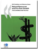
-
January
27,
2009
Numerous
maps,
charts
and
diagrams
were
prepared
for
the
publication
and
later
modified
by
the
publication
team.
All
illustrations
that
were
prepared
are
available
from
UNEP/GRID-Arendal,
and
the
report
can
be
viewed
or
ordered
from
OECD.
-
2008
-
International
Polar
Year
(IPY)
educational
posters
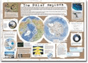
-
July
31,
2008
Project
management,
editing,
research,
graphics
production
and
layout
of
five
posters
on
current
research-
and
sustainable
development
issues
in
the
polar
regions.
The
posters
are
available
for
download
from
UNEP/GRID-Arendal,
and
all
graphics
are
also
available
separately.
-
-
ESRI
Map
book
vol
23
-
July
1,
2008
The
annual
ESRI
Map
Book
presents
a
selection
of
the
best
maps
prepared
using
ESRI
ArcGIS
software
in
the
previous
year.
The
book
is
presented
at
the
ESRI
International
User
Conference
in
San
Diego,
in
July.
The
2008
map
book,
volume
23,
was
presented
at
the
conference
held
on
July
2008.
A
world
map
prepared
for
the
UNEP
Global
Outlook
of
Ice
and
Snow
was
included
in
this
volume,
showing
the
distribution
and
different
elements
of
the
cryosphere.
Available
online
at
the
ESRI
Map
Book
Gallery,
or
for
order
through
the
ESRI
Store.
-
-
Cartography
Design
Annual
#1
-
July
1,
2008
The
Cartography
Design
Annual
is
a
book
showcasing
a
collection
of
the
best
maps.
For
the
2008
volume
a
world
map
presenting
the
various
elements
of
the
cryosphere
was
included.
For
more
information
and
ordering,
see
http://www.lulu.com/shop/nick-springer/cartography-design-annual-1/paperback/product-3327040.html.
-
-
World
Resources
Report
2008
-
Roots
of
Resilience
-
Growing
the
Wealth
of
the
Poor
-
July
1,
2008
Assorted
maps
and
diagrams,
and
editorial
collaboration.
The
report
and
graphics
resources
are
available
on
the
report
website,
and
from
UNEP/GRID-Arendal.
-
-
In
Dead
Water
-
Merging
of
climate
change
with
pollution,
over-harvest,
and
infestations
in
the
world's
fishing
grounds
(Rapid
Response
Assessment)
-
February
22,
2008
Graphics
editor,
research,
data
collection
and
preparation
of
all
graphics
for
the
report.
See
the
report
website
for
more
information
and
the
graphics
prepared
for
the
report.
-
2007
-
ESRI
Map
book
vol
22
-
July
1,
2007
The
annual
ESRI
Map
Book
presents
a
selection
of
the
best
maps
prepared
using
ESRI
ArcGIS
software
in
the
previous
year.
The
book
is
presented
at
the
ESRI
International
User
Conference
in
San
Diego,
in
July.
The
2007
map
book,
volume
22,
was
presented
at
the
conference
held
on
July
2007.
An
Arctic
topographic
map
prepared
for
the
Arctic
Council
working
group
on
conservation
was
selected
for
this
collection.
Available
in
the
ESRI
Store.
-
-
Global
Outlook
for
Ice
and
Snow
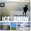
-
June
5,
2007
Graphics
editor,
research,
data
collection
and
preparation
of
all
graphics
for
the
report.
See
the
report
website
for
more
information
and
the
graphics
prepared
for
the
report.
-
2005
-
Poverty-Biodiversity
Mapping
applications
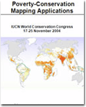
-
November
1,
2005
Research
and
participation
in
the
editorial
team.
Modelling
and
the
presentation
of
poverty
and
biodiversity
spatial
analysis,
including
map
production.
See
the
report
website
for
more
information
and
the
maps
prepared
for
the
report.
The
website
is
no
longer
available,
report
is
available
by
request.
-
-
Poverty
and
Environment
Times
#4:
The
Millennium
Development
Goals
Issue
-
September
20,
2005
Graphics
editor,
research,
data
collection
and
preparation
of
all
graphics
for
the
report.
See
the
issue
website
for
more
information
and
downloads
and
the
graphics
prepared
for
the
report.
-
-
Vital
Arctic
Graphics
-
May
17,
2005
Project
manager,
author,
graphics
editor,
research,
data
collection
and
preparation
of
graphics
for
the
report.
See
the
report
website
for
more
information
and
the
graphics
prepared
for
the
report.
-
2002
-
Global
Environment
Outlook
-
GEO-4
-
May
30,
2002
Graphics
editor,
research,
data
collection
and
preparation
of
all
graphics
for
the
report.
See
the
report
website
for
more
information
and
the
graphics
prepared
for
the
report.
-
The multidisciplinary study is a comprehensive assessment of Arctic change and resilience, including factors that appear to support or weaken resilience. It provides an overview of tools and strategies that can be used to assess and build resilience in the Arctic, and considers how the Arctic Council can contribute to those efforts. Hugo Ahlenius of Nordpil prepared all illustrations for the report, in close collaboration with the editorial team and contributing scientists. The report is available on the Stockholm Environment Institute website.
-
Shared Voices Magazine 2016
-
August 17, 2016
For the 2016 edition of Shared Voices magazine, which is the annual newsletter and annual report of the University of the Arctic, Hugo Ahlenius prepared an updated map of University of the Arctic members across the circumpolar Arctic, using ArcMap and Adobe Illustrator based on data supplied by the University of the Arctic secretariat.
-
Water and human livelihood resilience: a regional-to-global outlook
-
June 10, 2016
Scientific article, published in the Springer journal International Journal of Water Resources Development. Hugo Ahlenius of Nordpil assisted the author, Malin Falkenmark of Stockholm University, by preparing all illustrations for this article. He also prepared the document for submission, including reference management and formatting. The article reviews the current and future freshwater roles, needs and uses. Article available on the Springer website.
-
Global Biodiversity Outlook 4
-
October 6, 2014
Global Biodiversity Outlook (GBO) is the flagship publication of the Convention on Biological Diversity. It is a periodic report that summarizes the latest data on the status and trends of biodiversity and draws conclusions relevant to the further implementation of the Convention. The fourth edition of the Global Biodiversity Outlook draws on various sources of information to provide a mid-term assessment of progress towards the implementation of the Strategic Plan for Biodiversity. A map by Hugo Ahlenius, Nordpil, on Arctic indigenous languages is featured in the report. The report is available on the CBD website.
-
WWF Living Planet Report 2014
-
September 30, 2014
The Living Planet Report documents the state of the planet—including biodiversity, ecosystems, and demand on natural resources—and what this means for humans and wildlife. Published by WWF every two years, the report brings together a variety of research to provide a comprehensive view of the health of the earth. A map by Hugo Ahlenius, Nordpil, was featured displaying human impact on coastal areas, with the state in 2002 alongside a GLOBIO scenario for 2050. The report is available from the WWF Living Planet Report website.
-
ESRI Map book vol 29, 2014
-
July 14, 2014
The annual ESRI Map Book presents a selection of the best maps prepared using ESRI ArcGIS software in the previous year. The book is presented at the ESRI International User Conference in San Diego, in July. The 2014 map book, volume 29, was presented at the conference held on July 14-18, 2014. A map by Hugo Ahlenius, Nordpil, was selected for inclusion in this showcase. Soon available to read online at the ESRI Map Book Gallery and for order through the ESRI store.
-
Shared Voices Magazine 2014
-
May 1, 2014
For the 2014 edition of the Shared Voices magazine, the annual newsletter and annual report of the University of the Arctic (a circumpolar network of institutions), Hugo Ahlenius of Nordpil prepared a set of maps and diagrams. The illustrations demonstrate the wide span of the network in a map showing its geographic distribution, as well as in a graphic on student exchanges around the Arctic. The magazine is available from University of the Arctic.
-
Water Resilience for Human Prosperity
-
March 21, 2014
Humanity now constitutes the largest driving force for changes to the biosphere, and as a result of our actions, we are facing critical challenges. How can we handle governance and management of water resources in the context of rapid global change? Water Resilience for Human Prosperity (Rockström, Falkenmark, Folke et al) presents a new approach to water, addressing global sustainability and focusing on socio-ecological resilience. Topics covered include the risks of unexpected change; human impacts and dependence on global water; the prospects for feeding the world’s population by 2050; and a pathway for the future. Hugo Ahlenius of Nordpil coordinated the book production, prepared all the graphics and managed communication with the authors. Read more about the book on the Stockholm Resilience Centre website and at Cambridge University Press.
-
Arctic Ocean Acidification 2013: An Overview
-
March 1, 2014
Arctic Ocean Acidification 2013: An Overview summarizes the results of a study by the Arctic Monitoring and Assesment Programme (AMAP) featuring contributions from scientists from throughout the circumpolar north. The assessment examines how ocean acidification is affecting the Arctic seas, marine life, and the peoples of the Arctic, and considers future impacts of ocean acidification. Hugo Ahlenius of Nordpil prepared maps, charts and diagrams for the report, and handled some of the data management for the scientific report. The report is available for download from AMAP.
-
AMAP Assessment 2013: Arctic Ocean Acidification
-
December 1, 2013
Acidification in the world's seas is happening at a rapid and accelerating pace, and the Arctic Ocean is one of the frontlines for this global change. This assessment summarizes the state of science on the Arctic seas, and how this is affecting the marine environment, as well as possible developments for the future - for Arctic marine life and Arctic peoples. Hugo Ahlenius, Nordpil prepared maps, charts and diagrams for the report, as well as handled some of the data management. The report is available for download from AMAP.
-
Life Linked to Ice: a guide to
sea-ice-associated biodiversity in this time
of rapid change
-
October 17, 2013
Report from the Arctic Council, and the Conservation of Arctic Flora and Fauna (CAFF) working group that examines sea-ice-associated biodiversity on land in the marine, and climate change. As the ice is reduced, the report looks at the impacts for marine species as well as human communities. The report features maps by Hugo Ahlenius, Nordpil. Report available from CAFF.
-
Essential Mapwork Skills 3
-
September 1, 2013
Textbook teaching geographical skills designed for GCSE and A Level specifications, by Simon Ross and published by Nelson Thornes. The book features thirty case studies on physical, human and issue-based geographical topics. An Arctic topographic map by Hugo Ahlenius, Nordpil is provided to give context to a case on global warming and the fate and future of the Arctic sea ice. For more information, please refer to Nelson Thornes.
-
Sweden’s evolving hydropower sector:
Renovation, restoration and
concession change
-
August 1, 2013
A new report from the Stockholm Environment Institute reviews developments in Sweden's hydropower sector between 1990 and 2012. The report Sweden’s evolving hydropower sector: Renovation, restoration and concession change by Peter Rudberg focuses on existing infrastructure and installations and on their maintenance and upgrades. It also examines the measures taken to restore and maintain ecological qualities in the affected rivers. To provide an overview of the case studies in the report, Nordpil prepared an overview map of the hydropower stations covered, including descriptions.
-
ESRI Map book vol 28, 2013
-
July 8, 2013
The annual ESRI Map Book presents a selection of the best maps prepared using ESRI ArcGIS software in the previous year. The book is presented at the ESRI International User Conference in San Diego, in July. The 2013 map book, volume 28, was presented at the conference held on July 8-12, 2013. Four maps by Hugo Ahlenius, Nordpil, are featured in the book, including a bathymetry map of the Arctic Ocean on the cover. Available to read online at the ESRI Map Book Gallery and for order through the ESRI store.
-
Shared Voices Magazine 2013
-
May 17, 2013
Graphics previously prepared by Nordpil were updated in early 2013 with new data: statistics of exchanges in the University of the Arctic North2North student mobility program. The program allows exchanges among higher education institutions in the Arctic. Several maps and circular diagrams were prepared, one of which is featured in the 2013 issue of Shared Voices magazine. Read more on the University of the Arctic website.
-
Arctic Resilience
Interim Report 2013
-
May 15, 2013
The Arctic Resilience Interim Report 2013 was presented in May at the Kiruna Ministerial meeting of the Arctic Council. The interim report represents a major milestone in a multi-year effort in creating a comprehensive assessment on the state and resilience of the socio-ecological systems of the circumpolar north. Nordpil collaborated closely with the editorial team and contributing scientist to prepare all the diagrams, charts and maps in the interim report. The visuals were prepared to communicate the process and results in a clear and legible way for a wide audience. To read more about the report, and for download link, please refer to the Arctic Council Arctic Resilience Report website: http://www.arctic-council.org/arr/
-
Climate change
adaptation in
Swedish forestry: a
historical overview,
1990-2012
-
December 12, 2012
This report explores how climate change adaptation concerns were integrated into the Swedish forestry discourse in the period 1990–2010. Nordpil prepared overview map, charts and assisted with the design of the tables. Report available from SEI.
-
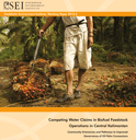
Competing water
claims in
biofuel
feedstock
operations in
Central
Kalimantan
-
November 3, 2012
This SEI working paper gauges the impacts of palm oil plantations from the perspective of local communities in Central Kalimantan, Indonesia, and identifies governance issues. It finds that local communities in Central Kalimantan Province have severe grievances, reporting that plantations pollute local rivers, lakes and aquifers, harming drinking water and killing fish, and also drying up community wells. Nordpil prepared an overview map integrating data and information from various sources. Report available from SEI.
-
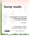
Results from
survey on
use and
capacity in
using
graphics to
communicate
environment
and
sustainable
development
issues
-
June 28, 2012
Results from survey on use and capacity in using graphics to communicate environment and sustainable development issues in 2010, to learn more about the way environmental and sustainable development professionals use charts, maps and diagrams, a short survey was prepared. The results are published in this report, and they provide an interesting picture of needs and capabilities in for preparing and using graphics for communication related to climate change, environmental issues and sustainable development. The results are been summarized in this report. Report available from this website.
-
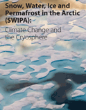
Snow,
Water,
Ice and
Permafrost
in the
Arctic
(SWIPA)
Scientific
report
-
May 14, 2012
The assessments in Snow, Water, Ice and Permafrost in the Arctic (SWIPA) represent an important milestone in the study of climate change and its impacts. The report examines changes in snow cover, temperatures, glaciers, ice caps, permafrost and sea ice. A key finding is that virtually all parts of the arctic's frozen regions are being affected by increases in temperature. Released in April 2012, the report is the result of many years of work, and includes contributions from a diverse range of institutions. Nordpil assisted in preparing graphics and data research. The report is available from AMAP.
-
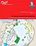
Arctic
Protected
Areas
Monitoring
Scheme
Background
Paper
-
December 6, 2011
As a benchmark and background study, the conservation programme of the Arctic Council has performed an inventory of protected areas, such as national parks, in the circumpolar arctic. The Conservation of Arctic Flora and Fauna (CAFF) has examined the current status using best available data to review the status of protection of land and marine environments. The report was published in the CAFF Monitoring Series, as report #5. Nordpil prepared all the national and circumpolar maps for this study. The report is available on the Arctic Portal website. A map from this report has been added to the portfolio section: Protected Areas of the Arctic.
-
TheGlobe
-
November 8, 2010
A plugin for Petrel for interactive management, browsing and exploration of continental shelves and the ocean floor in a 3D view. Nordpil prepared a number of layers for background information on geology and environmental factors for the sea column. Available for purchase through the Ocean Store.
-
Protecting
Arctic
Biodiversity
-
October 27, 2010
An in-depth review of existing multilateral environmental agreements and their role for the Arctic environment, including treaties such as the Convention on Biological Diversity (CBD). The report covers selected case studies on such topics as climate change, polar bears, seals and an ecosystem approach. Nordpil worked with the editors to prepare maps for the report, including adapting existing graphics from the UNEP/GRID-Arendal graphics library. The publication is available on the UNEP/GRID-Arendal website, and graphics from the report have been published at maps.grida.no.
-
The
Last
Stand
of
the
Orangutan
-
State
of
emergency:
illegal
logging,
fire
and
palm
oil
in
Indonesia's
national
parks
(Rapid
Response
Assessment)
-
June 29, 2010
A study in the UN Environment Programme Rapid-Response Assessment series, on the status of Orangutans - trade, deforestation and habitat destruction in Malaysia and Indonesia - Sumatra and Borneo. Graphics editor, research, data collection and preparation of all graphics for the report. See the report website for more information and this link for the graphics prepared for the report.
-
Arctic
Biodiversity
Trends
2010:
Selected
indicators
of
change
-
May 5, 2010
An overview of the ecology of the Arctic is presented in the report Arctic Biodiversity Trends 2010: Selected Indicators of Change, presented by the Arctic Council in May 2010. Nordpil prepared all the maps, charts and diagrams for this publication, and worked closely with the editorial team from UNEP/GRID-Arendal and the CAFF Secretariat. Two maps from this report are presented in the portfolio section: red knot migration and vegetation trends in the Arctic. The report is available from the arcticbiodiversity.is website.
-
Catalysing
change
-
the
UNECE
response
to
the
climate
countdown
-
December 5, 2009
Some of the member states of the United Nations Economic Commission for Europe (UNECE), notably the US and Canada and some EU member states, are among the main emitters of greenhouse gases. The report Catalysing change - the UNECE response to the climate countdown, prepared for the COP15 climate conference in December 2009, summarizes activities among UNECE member states to mitigate and act on climate change. Nordpil prepared and edited all illustrations for this report (partly based on previous work by UNEP/GRID-Arendal). Full layout and graphic design by Nordpil. Three illustrations from this report are presented in the portfolio section: cover, cartogram and a chart. The report is available for download from the UNECE.
-
Cartography
Design
Annual
#2
-
December 1, 2009The second Cartography Design Annual features selected outstanding examples of map artwork published in 2008. The maps were chosen based on the clarity of the information, the appeal of the visual design, and the quality of the production. A map by Hugo Ahlenius, prepared for UNEP/GRID-Arendal, was selected for this volume. The map presents climate scenarios for the Arctic region. See map portfolio to view this map. The report can be ordered from the publisher.
-
Effekt
-
klimatmagasinet
2009/2
-
November 1, 2009
The 2009/02 issue of the Swedish climate magazine Effekt features maps prepared by Nordpil. The illustrations accompany an article on vulnerability to climate change in Sweden. See map portfolio for samples. The report is available from the publishers.
-
UArctic
Shared
Voices
-
Thematic
Networks
issue
-
May 14, 2009
Nordpil contributed a series map illustrating the networks of the University of the Arctic using data supplied by the UArctic secretariat. The data was then manipulated and georeferenced to match the background map. See map portfolio for sample and links.
-
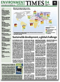
Poverty
and
Environment
Times
#5:
The
Pro-Poor
Growth
Issue
-
May 12, 2009Participated in the editorial team and designed maps and charts for the newspaper. The publication is available on the Environment Times website, and from the UNEP/GRID-Arendal maps and graphics library.
-
Reindeer
husbandry
and
Barents
2030
-
Impacts
of
future
petroleum
development
on
reindeer
husbandry
-
May 6, 2009
The future for reindeer husbandry in the Barents region is highly dependent on the availability of grazing land. Extensive oil and gas development will likely lead to loss of vital ranges, in particular coastal summer pastures and calving grounds. Reindeer husbandry and Barents 2030 presents new potential scenarios for reindeer husbandry, combining the GLOBIO methodology for mapping loss of biodiversity with the extensive oil and gas development pictured in the scenarios. Maps and analysis by Nordpil are used in the report. Full report available from UNEP/GRID-Arendal.
-
The
Environmental
Food
Crisis
-
The
Environment's
Role
in
Averting
Future
Food
Crises
-
February 7, 2009
Nordpil prepared 30 illustrations, with research and documentation, in close collaboration with the editorial team. Hugo Ahlenius served as graphics editor. Full report and more information available from UNEP/GRID-Arendal, all graphics are accessible in the UNEP/GRID-Arendal maps and graphics library.
-
Natural
Resources
and
Pro-Poor
Growth
-
DAC
Guidelines
and
References
Series
-
January 27, 2009Numerous maps, charts and diagrams were prepared for the publication and later modified by the publication team. All illustrations that were prepared are available from UNEP/GRID-Arendal, and the report can be viewed or ordered from OECD.
-
International
Polar
Year
(IPY)
educational
posters
-
July 31, 2008Project management, editing, research, graphics production and layout of five posters on current research- and sustainable development issues in the polar regions. The posters are available for download from UNEP/GRID-Arendal, and all graphics are also available separately.
-
ESRI
Map
book
vol
23
-
July 1, 2008
The annual ESRI Map Book presents a selection of the best maps prepared using ESRI ArcGIS software in the previous year. The book is presented at the ESRI International User Conference in San Diego, in July. The 2008 map book, volume 23, was presented at the conference held on July 2008. A world map prepared for the UNEP Global Outlook of Ice and Snow was included in this volume, showing the distribution and different elements of the cryosphere. Available online at the ESRI Map Book Gallery, or for order through the ESRI Store.
-
Cartography
Design
Annual
#1
-
July 1, 2008
The Cartography Design Annual is a book showcasing a collection of the best maps. For the 2008 volume a world map presenting the various elements of the cryosphere was included.
For more information and ordering, see http://www.lulu.com/shop/nick-springer/cartography-design-annual-1/paperback/product-3327040.html. -
World
Resources
Report
2008
-
Roots
of
Resilience
-
Growing
the
Wealth
of
the
Poor
-
July 1, 2008Assorted maps and diagrams, and editorial collaboration. The report and graphics resources are available on the report website, and from UNEP/GRID-Arendal.
-
In
Dead
Water
-
Merging
of
climate
change
with
pollution,
over-harvest,
and
infestations
in
the
world's
fishing
grounds
(Rapid
Response
Assessment)
-
February 22, 2008Graphics editor, research, data collection and preparation of all graphics for the report. See the report website for more information and the graphics prepared for the report.
-
ESRI
Map
book
vol
22
-
July 1, 2007
The annual ESRI Map Book presents a selection of the best maps prepared using ESRI ArcGIS software in the previous year. The book is presented at the ESRI International User Conference in San Diego, in July. The 2007 map book, volume 22, was presented at the conference held on July 2007. An Arctic topographic map prepared for the Arctic Council working group on conservation was selected for this collection. Available in the ESRI Store.
-
Global
Outlook
for
Ice
and
Snow
-
June 5, 2007
Graphics editor, research, data collection and preparation of all graphics for the report. See the report website for more information and the graphics prepared for the report.
-
Poverty-Biodiversity
Mapping
applications
-
November 1, 2005Research and participation in the editorial team. Modelling and the presentation of poverty and biodiversity spatial analysis, including map production. See the report website for more information and the maps prepared for the report. The website is no longer available, report is available by request.
-
Poverty
and
Environment
Times
#4:
The
Millennium
Development
Goals
Issue
-
September 20, 2005
Graphics editor, research, data collection and preparation of all graphics for the report. See the issue website for more information and downloads and the graphics prepared for the report.
-
Vital
Arctic
Graphics
-
May 17, 2005
Project manager, author, graphics editor, research, data collection and preparation of graphics for the report. See the report website for more information and the graphics prepared for the report.
-
Global
Environment
Outlook
-
GEO-4
-
May 30, 2002Graphics editor, research, data collection and preparation of all graphics for the report. See the report website for more information and the graphics prepared for the report.