Follow Nordpil on Twitter!
March 3, 2010
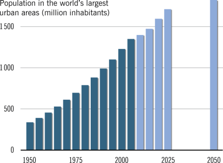
Updated - World database of urban areas, 1950-2050

The database of cities and megacities has been updated to version 1.1. Coordinates have been corrected and the license changed, among other things. The data is available as maps, for Google Earth, in an animation video and for GIS data download.