Follow Nordpil on Twitter!
UArctic student network exchange maps and diagrams
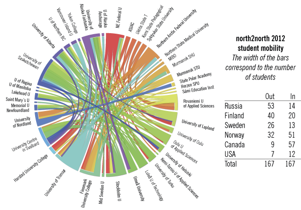
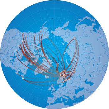 Graphics previously prepared by Nordpil
were updated in early 2013 with new data: statistics of exchanges in the University of the
Arctic North2North student mobility program. The program allows exchanges among higher education
institutions in the Arctic. Several maps and circular diagrams were prepared, one of which is
featured in the 2013 issue
of Shared Voices magazine.
Graphics previously prepared by Nordpil
were updated in early 2013 with new data: statistics of exchanges in the University of the
Arctic North2North student mobility program. The program allows exchanges among higher education
institutions in the Arctic. Several maps and circular diagrams were prepared, one of which is
featured in the 2013 issue
of Shared Voices magazine.
The 2012 exchange programme statistics were analyzed and aggregated using Microsoft Excel and Microsoft Access, and exported for use in Circos and ESRI ArcGIS.
The map was prepared using Geographic Information Systems (GIS) software - ESRI ArcGIS/ArcMap. The cartographic design was finalized in Adobe Illustrator.
The circular diagram was done through Circos and further refined in Adobe Illustrator.