 Follow Nordpil on Twitter!
Cartogram Geoprocessing Tool for ArcGIS

 We have prepared cartograms here at Nordpil, originally using the command-line tool provided by Gastner and
Newman for their methodology - you can see an example of that here in the cartogram on safe access to
water, prepared at UNEP/GRID-Arendal. That method was quite cumbersome, and meant
conversion of the data in multiple steps, and less control over the result.
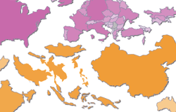
We have prepared cartograms here at Nordpil, originally using the command-line tool provided by Gastner and
Newman for their methodology - you can see an example of that here in the cartogram on safe access to
water, prepared at UNEP/GRID-Arendal. That method was quite cumbersome, and meant
conversion of the data in multiple steps, and less control over the result.
Over the years, we have tested different methods, and the easiest one - so far - is the toolbox for ArcGIS provided by Tom Gross for free download through the ArcScripts repository (through the ESRI Attribution and Licensing Agreement).
This utility, fully compatible with ArcGIS 9.3.1 and set up as a toolbox, provides easy access to cartogram functions that are fast and convenient, from inside ArcGIS.
You can see examples of this tool in action in the Nordpil portfolio gallery, in the cartogram over greenhouse gas emissions, prepared for the 2009 UNECE publication Catalysing change - the UNECE response to the climate countdown.
To download the Cartogram Toolbox, visit the ArcScripts download page.