 Follow Nordpil on Twitter!
Världens länder ("Countries of the world")

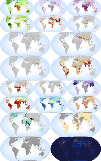 For an
upcoming educational website, the Swedish online encyclopedia Nationalencyclopedin
turned to Nordpil for the preparation of a collection of thematic maps. The website,
Världens Länder, will feature information about countries and the world, and the world
maps present a variety of themes related to the environment, sustainable development and global
politics.
For an
upcoming educational website, the Swedish online encyclopedia Nationalencyclopedin
turned to Nordpil for the preparation of a collection of thematic maps. The website,
Världens Länder, will feature information about countries and the world, and the world
maps present a variety of themes related to the environment, sustainable development and global
politics.
Data was acquired from a multitude of publicly available sources, including figures from the UN, NASA and the WorldBank.
The maps, prepared in the Wagner VII equal-area projection, were prepared using GlobalMapper and ESRI ArcGIS with some data management in Microsoft Access.
The maps were then finalized using Adobe Illustrator for best available quality for web use.
Themes included:
- Refugees
- Natural disasters (earthquakes, volcanoes, slides, cyclones)
- Landcover
- Land acquisitions
- Nighttime lights
- Population density
- Precipitation
- Temperature
For more information, see ne.se (in Swedish):