 Follow Nordpil on Twitter!
Thematic network maps for the University of the Arctic

The University of the Arctic (UArctic) is a network of centers of higher education and research institutes that are based in a variety of locations in the circumpolar North and that work with Arctic issues.
One of the key parts of the cooperation among academic institutions under UArctic is the thematic networks.
UArctic's thematic networks foster issues-based cooperation within networks which are focused but flexible enough to respond quickly to topical Arctic issues. They form a natural framework for development of UArctic education and research, providing an optimal structure for increasing knowledge generation and knowledge-sharing across the North.
The networks consist of experts in specific areas of northern relevance, and focus on research cooperation, knowledge-sharing, curriculum development and joint education programs. Experts within the network participate in international working groups.
Existing networks are: Arctic Engineering and Science, Health and Well-being in the Arctic, Digital and Media Arts, Energy in a New Time, Indigenous Arts and Crafts, Local and Regional Development in the North, Northern Governance, Social Work, Northern Food Security, Arctic Sustainable Arts and Design, Arctic Coastal and Marine Issues, Arctic Law, Managing Small and Medium Sized Enterprises in the North, Environmental Impact Assessment of Industry Contaminated Areas, Environmental Training and Education for Sustainable Development of the Arctic, Distance Education and E-learning, Arctic Extractive Industries, Arctic Geology, Communicating Arctic Science, Polar ice, climate and land dynamics (PICD), Global change in the Arctic, Northern Tourism, Verrde Program, World Image of the indigenous Peoples of the North and Geopolitics and Security.
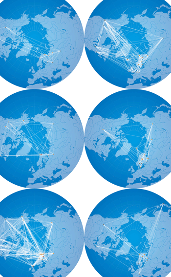
Nordpil was contracted by the UArctic secretariat to prepare a set of maps for each of the 25 networks, illustrating the collaborations and connections across the universities and other institutions. The data was delivered in spreadsheet format, and was modified into a Microsoft Access database as well as into Geographic Information Systems (GIS) format. The map preparation was automated in ArcGIS and Adobe Illustrator using Python and JavaScript respectively, and prepared as a batch.