 Follow Nordpil on Twitter!
Swedish polar research portal

 The
Swedish Polar Research Secretariat is working on a new website and portal presenting
its work. The main interface will be an interactive map interface. Nordpil was assigned the task
of assembling a database of GIS data for the polar regions, including both the Arctic and
Antarctica. From this database a background map was prepared using TileMill and MapBox.
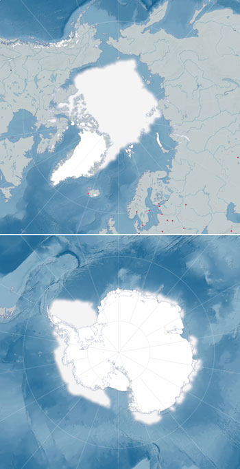
The
Swedish Polar Research Secretariat is working on a new website and portal presenting
its work. The main interface will be an interactive map interface. Nordpil was assigned the task
of assembling a database of GIS data for the polar regions, including both the Arctic and
Antarctica. From this database a background map was prepared using TileMill and MapBox.
The database was primarily based on the Natural Earth dataset collection and the data was projected, reviewed and edited using QGis and ESRI ArcGIS. Additional data was pulled in for the digital elevation model, from the Global Multi-resolution Terrain Elevation Data 2010 (GMTED2010) dataset and International Bathymetric Chart of the Arctic Ocean (IBCAO) dataset. For Antarctica data was also downloaded from the Antarctic Digital Database Version 6.0 (ADD). Sea-ice extent data was acquired from the National Snow and Ice Data Center (NSIDC).
The background elevation was further edited in Adobe Photoshop, with styling inputs from project participants from the Bror Rudi agency.
The map data was styled using CartoCSS in TileMill and then uploaded to the MapBox service.
The background map will be integrated into the upcoming website using additional interactive tools and a JavaScript viewer interface.