 Follow Nordpil on Twitter!
Natural Earth in Wagner VII projection - GIS data

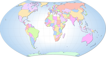 This
is a complete database of basemap/reference GIS data in Wagner VII projection, using the Natural
Earth 2.0 database reprojected and edited. This is primarily for use in GIS software like QGis,
ArcGIS, MapInfo and others, as well as for GIS-enabled web applications (GeoServer, ArcGIS
Server, MapServer and more).
This
is a complete database of basemap/reference GIS data in Wagner VII projection, using the Natural
Earth 2.0 database reprojected and edited. This is primarily for use in GIS software like QGis,
ArcGIS, MapInfo and others, as well as for GIS-enabled web applications (GeoServer, ArcGIS
Server, MapServer and more).
For preparing global thematic maps, the Wagner VII projection, with 10E as the central meridian (See here and here for more information) represents a good solution. The projection is equal-area and has a decent trade-off in shape distortion. One problem with the projection is that it is not supported in some of the common desktop GIS packages, like ArcGIS and QGis. When it is supported (as in Saga GIS and GlobalMapper) data is sometimes distorted in the view/reprojection process. By using 10E as the central meridian one avoids the problem of a far sliver of Russia being split up.
The data has been carefully reprojected using GlobalMapper, and then edited and reviewed using QGis and ArcGIS.
The collection is complete with a few exceptions (most notably the raster data).
All the data has been made available in the public domain.
For more information and download links, please refer to the
GitHub repository for the database:
https://github.com/fraxen/naturalearth_wagnerVII