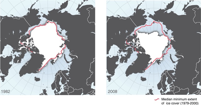
Arctic minimum sea ice extent, 1982 and 2008
The Arctic represents an early warning case of global changes in our climate. The extent and age of the Arctic sea ice is one of these important indicators of climate change. The Arctic summer of 2007 represented an all-time-low in terms of extent of Arctic sea ice, with a slight recovery in 2008 - presented in the above figure. The retreat of the ice is most obvious along the coast of Europe and Asia - opening up the Northern Sea Route between the Pacific and Atlantic oceans. Data for the map were retrieved from NSIDC.
Figure prepared for the UN Environment Programme (UNEP) report Global Outlook on Ice and Snow in 2007. The map was revised in 2008 with the addition of the most recent data available at that time.
The map was prepared with scientific data, which were further converted, projected and simplified.
The software used in this map production was primarily ESRI ArcGIS and Adobe Illustrator.
For more information, downloads and full data sources, please refer to:
Do you need powerful, clear and good-looking illustrations?
Nordpil specializes in creating the best maps, charts and diagrams for high-profile publications, please contact us and describe your needs, and we will get back to you with a quote.
Would you like to learn how to prepare better maps, charts and diagrams?
In our training workshops you will learn about the theory about creating powerful visual material based on scientific data and statistics, and we discuss and deconstruct examples from recent publications, news and your work. Read more on our workshop pages.
 Follow Nordpil on Twitter!
